Driving the Icefields Parkway: Banff to Jasper Stops & Guide 2026
The Icefields Parkway is often called one of the most beautiful drives on earth, and for once the billing holds up. In about 230 km it links Lake Louise to Jasper through a corridor of glaciers, turquoise lakes and waterfalls, with the Columbia Icefield roughly at its midpoint. This guide runs the whole route in order, south to north, with the stops that matter, the practical warnings that save the day, and the choice between driving it yourself and letting a tour take the wheel.
Turn the route from Lake Louise to Jasper into a sightseeing transfer with glacier attractions included. Explore The Journey To Jasper
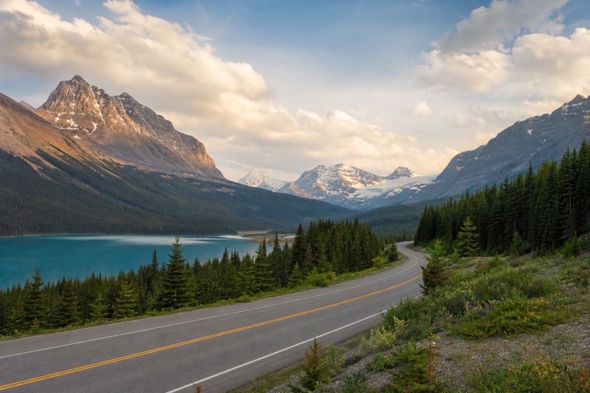
A road built purely for the view is a rare thing, and the Icefields Parkway is one. It threads the spine of the Canadian Rockies between Lake Louise and Jasper, past more than a hundred glaciers, and it saves its centrepiece for the middle, where the Columbia Icefield spills almost to the roadside. You can drive it in three or four hours flat. You should not. This is a day, not a transit, and the stops below are the reason.
The Icefields Parkway, south to north: Lake Louise to Jasper
Stops are shown in order along Highway 93N. Distances are approximate road distances from Lake Louise; the Columbia Icefield sits roughly at the midpoint, and the only fuel is at Saskatchewan River Crossing.
What is the Icefields Parkway?
The Icefields Parkway is Highway 93N, a roughly 230 km scenic route linking Lake Louise in Banff National Park to Jasper in Jasper National Park. It runs through some of the most protected wilderness in North America and passes the Columbia Icefield near its midpoint.
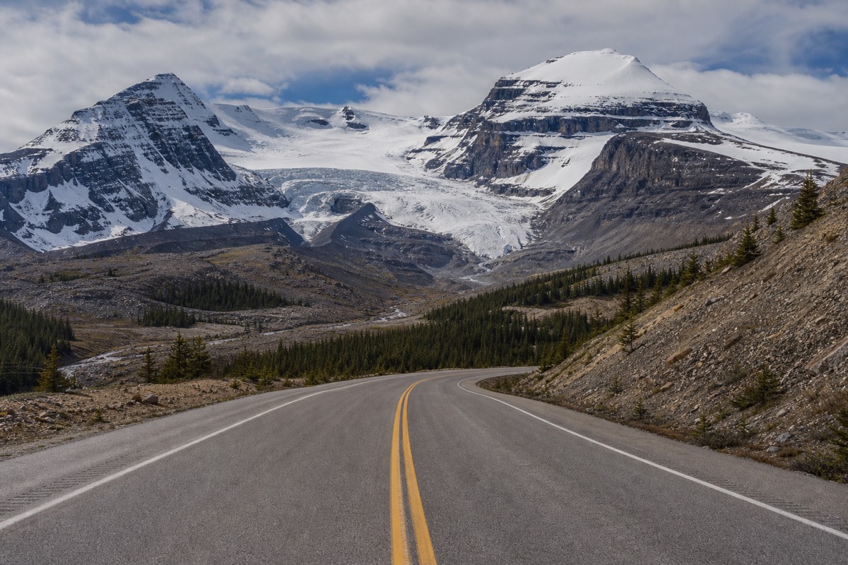
It is a paved, two-lane highway, not a backcountry track, but it feels wilder than most roads because there is so little on it: no towns, one fuel stop, and long stretches without a building in sight. The whole corridor lies within national parks that form part of a UNESCO World Heritage area, which is one reason it stays so undeveloped. That emptiness is the appeal and the catch at once, glorious to look at, and a place you plan for rather than wing.
How long does it take to drive the Icefields Parkway?
Nonstop, about three to four hours from Lake Louise to Jasper. Realistically, give it a full day. With stops at Bow Lake, Peyto Lake, the Columbia Icefield and the waterfalls near Jasper, most people spend eight to ten hours end to end, and many split it across two. If you are timing only the northern half, we cover exactly how far Jasper is from the icefield.
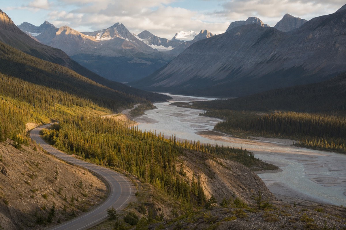
The math is simple once you accept it. Every few kilometres there is a pullout worth using, and the Columbia Icefield in the middle can swallow two or three hours on its own if you ride onto the glacier. Trying to do the Parkway as a quick hop misses the entire point and leaves you fighting the urge to stop. If you only have part of a day, a better plan is to drive half of it well, say Lake Louise to the icefield and back, rather than rushing the whole thing. The section on driving the drive up from Banff covers that southern half in more detail.
It helps to see the route as a few big legs rather than one long haul. The distances between the key points break down like this.
| Leg | Approx distance | Approx driving time |
|---|---|---|
| Lake Louise to Bow Lake and Peyto Lake | ~40 km | ~40 min |
| Peyto Lake to Saskatchewan River Crossing | ~35 km | ~30 min |
| Saskatchewan River Crossing to Columbia Icefield | ~55 km | ~45 min |
| Columbia Icefield to Jasper | ~100 km | ~1 hr 15 min |
| Lake Louise to Jasper (full Parkway) | ~232 km | ~3 to 4 hr driving |
What does a full day on the Parkway look like, hour by hour?
A well-paced day covers the southern lakes in the morning, the Columbia Icefield in the middle of the day, and the northern waterfalls on the way into Jasper. The glacier gets the biggest block of time; everything else is a series of short, high-value stops strung along the road.
Guided tours run close to this rhythm, and self-drivers do well to copy it, because it puts the still lakes in the calm morning light and reaches the icefield before the afternoon weather builds. The sample schedule below is illustrative, not fixed, and assumes a round trip that turns around after the falls rather than continuing to Jasper.
| Approx time | Where you are |
|---|---|
| 8:00 am | Leave Lake Louise, first stop Herbert Lake |
| 9:00 am | Crowfoot Glacier and Bow Lake |
| 9:45 am | Peyto Lake overlook |
| 10:45 am | Mistaya Canyon, then Saskatchewan River Crossing |
| 11:45 am | Arrive Columbia Icefield Glacier Discovery Centre |
| 12:00 pm | Ice Explorer onto the Athabasca Glacier |
| 1:45 pm | Lunch, then the Glacier Skywalk |
| 3:30 pm | Athabasca and Sunwapta Falls |
| 4:30 pm | Turn back south, or continue into Jasper |
What are the best stops on the Icefields Parkway, south to north?
Driving north from Lake Louise, the highlights fall in this order: Herbert Lake, the Crowfoot Glacier viewpoint, Bow Lake, the Peyto Lake overlook, the Waterfowl Lakes, Mistaya Canyon, Saskatchewan River Crossing, the Weeping Wall, the Columbia Icefield, then Sunwapta Falls and Athabasca Falls before Jasper.
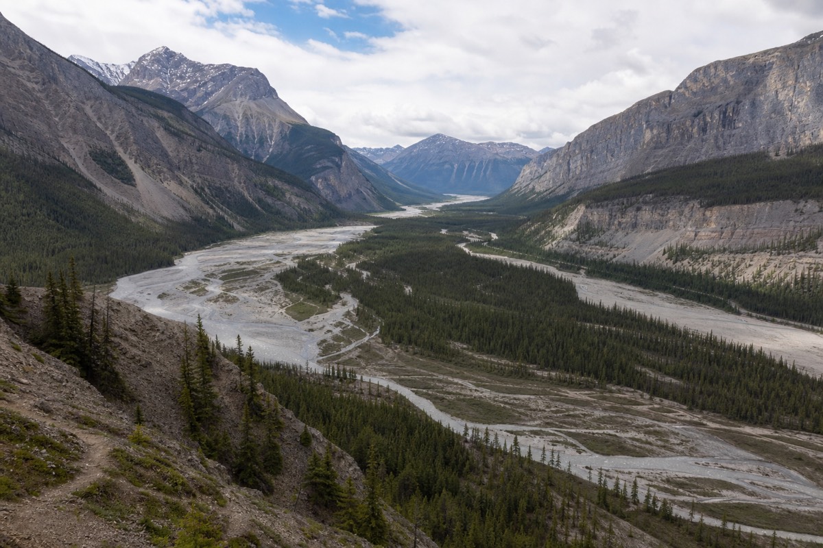
You will not stop at every one, and you do not need to. The table below lays them out in sequence with what each offers and roughly how long to give it, so you can build a day that matches your pace. Treat the Columbia Icefield as the anchor and plan the rest around it.
| Stop (south to north) | What it is | Suggested time |
|---|---|---|
| Herbert Lake | Quiet reflection lake near Lake Louise | 10 min |
| Crowfoot Glacier viewpoint | Hanging glacier on the mountainside | 10 min |
| Bow Lake | Broad, often mirror-still lake below Bow Glacier | 20 to 40 min |
| Peyto Lake overlook | Wolf-shaped turquoise lake from above | 20 to 30 min |
| Waterfowl Lakes | Calm, less-visited lakes and campground | 10 to 15 min |
| Mistaya Canyon | Short walk to a narrow carved gorge | 20 min |
| Saskatchewan River Crossing | The only fuel, food and washrooms midway | as needed |
| Weeping Wall | Cliff face streaming with meltwater | 5 to 10 min |
| Columbia Icefield | Athabasca Glacier, Ice Explorer and Skywalk | 2 to 3 hours |
| Sunwapta & Athabasca Falls | Powerful falls on the run into Jasper | 20 to 30 min each |
Herbert Lake, Lake Louise and the start of the drive
The Parkway begins just north of Lake Louise, and the first few kilometres set the tone. Herbert Lake, moments up the road, is a small mirror lake that catches the peaks on a still morning, a gentle warm-up before the bigger sights that follow.
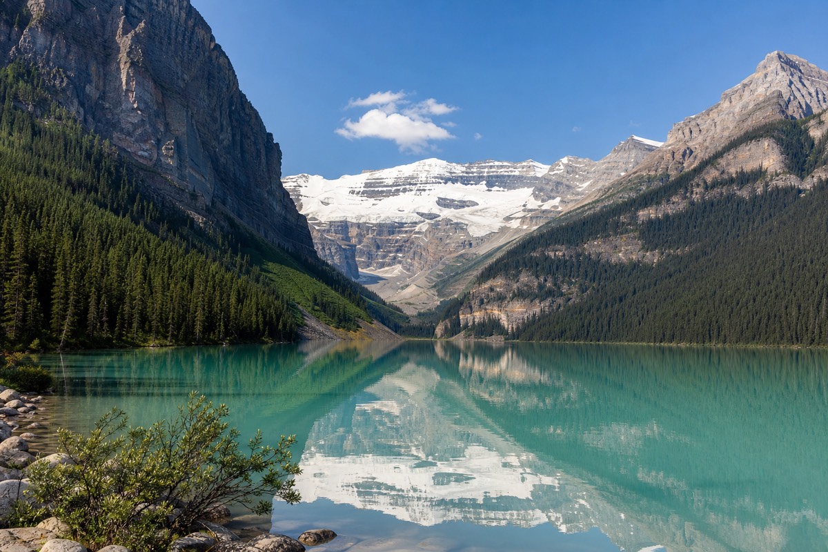
Lake Louise itself is not on the Parkway proper, it sits just off the southern entrance, but almost everyone folds it into the drive. Reach it early, because its car parks fill by mid-morning in summer and stay full. From there the road turns north and the traffic thins fast; within twenty minutes of leaving Lake Louise you are in country that feels genuinely remote. This is the moment to have already filled your tank, because the next reliable fuel is far up the road.
Crowfoot Glacier, Bow Lake and Peyto Lake
This trio is the scenic heart of the southern Parkway. The Crowfoot Glacier hangs off the mountain above the road, Bow Lake spreads mirror-flat beneath Crowfoot Mountain, and the Peyto Lake overlook delivers the wolf-shaped turquoise view that ends up on every postcard of the drive.
Peyto Lake earns its fame. A short paved path climbs from the car park to a viewpoint above the tree line, and the lake below glows an almost artificial blue, colored by rock flour that glaciers grind and wash into the water. Bow Lake, a little south, is the calmer counterpoint, often glassy at dawn and framed by the Bow Glacier feeding it. Give Bow Lake a shore walk if you have time; give Peyto the ten-minute climb without fail. These are the stops that make the drive worth choosing over any faster route.
Mistaya Canyon, Saskatchewan River Crossing and the Weeping Wall
The middle stretch trades wide lakes for tighter drama. Mistaya Canyon is a short walk to a gorge the river has carved into a slot, Saskatchewan River Crossing is the practical hub with the route's only fuel, and the Weeping Wall is a cliff that runs with meltwater in summer and freezes into ice climbs in winter.
Saskatchewan River Crossing deserves a note beyond scenery. It is the one place on the entire Parkway to buy fuel and a meal, and prices there reflect the monopoly, so most people top up in Lake Louise and treat the Crossing as a backup and a washroom stop. Past it the road begins to climb in earnest toward the icefield, gaining height through switchbacks with the peaks closing in. Mistaya Canyon, just before the Crossing, is an easy and often overlooked ten-minute detour that rewards the walk.
The Columbia Icefield: Athabasca Glacier and the Skywalk
Roughly halfway to Jasper the road meets the Columbia Icefield, and this is the centrepiece. You can ride the Ice Explorer, a giant six-wheeled bus, onto the Athabasca Glacier to walk on the ice, and step onto the Glacier Skywalk, a glass-floored platform 280 metres above the Sunwapta Valley.
Everything here runs from the Glacier Discovery Centre beside the highway, which holds the ticket desks, a cafe and a buffet. The Ice Explorer is the draw, a massive purpose-built bus with tires taller than most adults; it carries you down onto the glacier for around twenty minutes on glacier ice, where you can walk a marked area and look at the meltwater channels. On the drive down you pass markers showing where the ice reached in 1890, 1920, 1950 and later decades, and the distance back to today's toe is a stark, honest picture of a retreating glacier. The Columbia Icefield sits near 1,900 metres and feeds eight major glaciers, so even in July this is cold, high country. The Skywalk pairs with it: cautious visitors can walk its solid-railed sections and skip the glass floor, since the view is nearly identical either way. Our deeper guides cover the Athabasca Glacier underfoot and the glass-floored Skywalk in full, and everything you need to know about the building itself is in the guide to the Glacier Discovery Centre. If you are driving the whole Parkway, budget two to three hours here, more than any other stop.
Sunwapta Falls, Athabasca Falls and into Jasper
North of the icefield the road descends toward Jasper, and two waterfalls mark the final stretch. Sunwapta Falls drops through a rock cleft, and Athabasca Falls, closer to Jasper, is a broad, thunderous cascade where the river forces through a narrow gorge. Both are short walks from the road.
This part of the drive feels different, greener and lower, as the high alpine gives way to forest. Athabasca Falls is the more powerful of the two and a favourite last stop before the Jasper townsite, especially in late afternoon light. From here Jasper is a short run north, and the Parkway ends where the town begins. If you are heading this direction as a one-way trip rather than a round trip, the northbound leg makes a natural transfer between the parks, covered in our full Lake Louise to Jasper guide.
One-way or round trip: how should you plan the drive?
Decide this before you book anything. A round trip from Banff or Lake Louise lets you see the Parkway in both directions and sleep in the same bed, but doubles the driving. A one-way run to Jasper covers less road twice and suits a bigger Rockies loop, though you then need onward transport or a one-way tour.
Most day visitors do the round trip, usually as far as the icefield and back, because it is simple and needs no logistics. Travellers stitching together a longer trip often prefer the one-way version, ending in Jasper to continue north or east. If you like the one-way idea but not the driving, a one-way glacier journey to Jasper handles the transfer, the glacier tickets and lunch in a single package. The table below weighs the two shapes.
| Factor | Round trip (out and back) | One-way to Jasper |
|---|---|---|
| Total driving | Double, same road twice | Single pass, less repetition |
| Lodging | Same base both nights | Different towns each end |
| Best for | Day trips, the icefield and back | Larger Banff to Jasper loops |
| Logistics | Simple | Needs onward transport or a one-way tour |
What do you need to know before driving the Parkway?
Four essentials keep the day smooth: fill your tank before you start because the only fuel is at Saskatchewan River Crossing, carry a valid park pass, download offline maps because cell service is almost nonexistent, and watch for wildlife on and beside the road, especially at dawn and dusk.
None of this is dramatic, but each item bites if you skip it. Running low on fuel with no signal and one distant pump is the classic Parkway mistake. Weather is the other variable: it can shift to rain or snow flurries up high even in summer, so pack layers and check the forecast the morning you go. Drive to the conditions, use the pullouts rather than stopping on the road, and give animals a wide berth. The essentials table below is the pre-trip checklist.
| Before you go | Why it matters |
|---|---|
| Full tank of fuel | Only one pump en route, at Saskatchewan River Crossing |
| Valid park pass | Required to stop anywhere in the national parks |
| Offline maps downloaded | Little to no cell service on the route |
| Warm layers, sunglasses, water | Weather turns fast; glare and cold at the icefield |
| Extra time in the schedule | Stops, wildlife jams and weather all add up |
Live road conditions, closures and pass details are kept current by Parks Canada, and the official route overview lives at the Icefields Parkway site. If the isolation gives you pause, our honest take on whether the drive feels scary may help you decide.
When is the best time to drive the Icefields Parkway?
June through September is the prime window, when the road is clear, the lakes have thawed to their brightest turquoise, and the Columbia Icefield attractions are running. September adds golden larches and thinner crowds; winter driving is possible but demands snow tires, caution and a viewpoints-only visit.
Within a summer day, the early morning is the reward hour: still lakes, soft light and the road nearly to yourself before the coaches roll north around mid-morning. Late afternoon is the second-best window as the crowds thin and the light warms. The glacier attractions typically operate from around early May to mid-October, so a trip outside that runs the Parkway for the scenery alone, which is still spectacular but colder and quieter. Our guide to the best time to drive it breaks the seasons down further.
| Season | Road and access | What to expect |
|---|---|---|
| May to mid-June | Open, icefield ramping up | Snow up high, fewer people |
| Late June to August | Full access | Brightest lakes, busiest road |
| September to mid-October | Open, winding down | Golden larches, crisp air |
| Late October to April | Winter driving, attractions closed | Snow tires, viewpoints only |
Should you drive it yourself or take a guided tour?
Self-drive for total control of your stops and timing; take a guided tour to skip the long haul, hand over the fuel and pass logistics, and hear the geology and history as you go. The Parkway suits both, and a good guide turns the empty stretches into the best storytelling of the day.
Self-driving is the choice for photographers, early risers and anyone who wants to linger. The cost is the effort: a long mountain highway, no signal, and the discipline to top up fuel and watch the weather. A guided day removes all of that and adds a local who knows exactly where to be for the light. If you would rather ride than drive, the most-booked Parkway day tour covers the classic stops, and a small-group Parkway departure keeps the group to 14. However you travel it, our team at Columbia Icefield Tours lists the departures that run this road daily through the season, with the tickets and the timing already sorted.