Athabasca Glacier: Walking on Ancient Ice at the Columbia Icefield
The Athabasca Glacier is the most visited glacier in North America, and it is also disappearing in front of us, which is exactly why people come. It flows off the Columbia Icefield to within sight of the highway, close enough that you can ride onto it, walk on it with a guide, or simply stand at its toe and read the markers that show how far it has pulled back. This guide covers the ice itself: how old, how big, how fast it is going, and how to meet it well.
Meet the Athabasca Glacier at walking pace with a guide and microspikes. Explore The Guided Glacier Hike
Walk to the rope at the toe of the Athabasca Glacier and you pass a line of small markers, each stamped with a year, each marking where the ice reached then. They start a surprising distance down the valley from where the ice sits now. That short walk is the honest introduction to this glacier: enormous, ancient, and shrinking fast enough to measure with your feet. Below is the ice in full, how old and how big it is, how quickly it is retreating, and the ways to actually stand on it.
The Athabasca Glacier, by the numbers
Length, thickness, age and the current rate of retreat for the Athabasca Glacier, drawn from the glacier's long-documented record and Parks Canada monitoring. These figures change year on year, so treat them as a recent snapshot rather than fixed values.
What is the Athabasca Glacier?
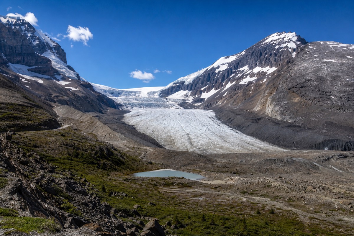
The Athabasca Glacier is one of the main outlet tongues of the Columbia Icefield, spilling down between mountain ridges to within a short walk of the Icefields Parkway. It is the most visited glacier in North America, largely because it is one of the few you can reach, ride onto and walk on without a mountaineering expedition.
The icefield above it is a vast, high plateau of ice that feeds several glaciers; the Athabasca is simply the one that flows closest to the road, which is why it, rather than its neighbours, became the one everybody sees. It sits inside a block of Rocky Mountain parks protected as a UNESCO World Heritage area, and it is watched and managed by Parks Canada. Everything visitor-facing runs from one building on the highway, covered in the guide to the Glacier Discovery Centre.
How old is the ice, really?
The Athabasca Glacier as a body of ice has built up over roughly the last ten thousand years, since the end of the last major ice age. The ice you actually touch at the toe is younger than that, snow that fell high on the icefield centuries ago and has slowly flowed down, but the glacier system itself is a relic of the deep past.
This confuses people, and fairly. A glacier is a conveyor: snow lands on the high icefield, compresses into ice, and creeps downhill over decades and centuries before melting out at the toe. So the glacier is ancient as a feature, while the specific ice at the bottom is a few hundred years old, having made the long journey down. We unpack the timeline properly in the piece on how old the ice is and whether it is melting.
How big is the Athabasca Glacier?
The Athabasca Glacier is around six kilometres long, covers roughly six square kilometres, and is up to about three hundred metres thick at its deepest, which is roughly the height of a very tall skyscraper of solid ice beneath your feet in the middle of the glacier.
Those numbers are hard to feel from the road, because the clear mountain air flattens the scale and the toe looks deceptively close. It is not: the walk that looks like ten minutes is more like half an hour, and the ice that looks a metre thick at the edge is hundreds of metres thick in the centre. Standing on it during the Ice Explorer ride onto the glacier is the moment the depth finally registers.
| Measure | Athabasca Glacier |
|---|---|
| Length | About 6 km |
| Area | Roughly 6 square km |
| Thickness | Up to about 300 m at the deepest |
| Source | The Columbia Icefield plateau above |
| Access | A short walk from the Icefields Parkway |
Is the glacier melting, and how fast?
Yes, and quickly. The Athabasca Glacier has pulled back more than 1.5 kilometres and lost over half its volume in roughly the last 125 years, and it is currently thinning and retreating on the order of five metres a year. The dated markers along the trail to the toe make the loss visible in a single short walk.
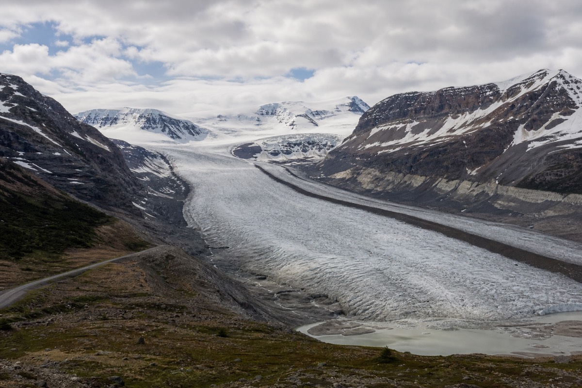
This is not abstract. Each marker sits where the ice ended in the year stamped on it, so you physically walk across a century of retreat to reach today's toe. Park authorities monitor the ice closely, and the trend is steady loss. That is a large part of why so many people prioritise a visit now: the glacier is receding within a human lifetime, and the experience of standing on it is changing year by year. The full account, including what the future likely holds, is in our piece on whether it is melting.
The scale of the loss is easy to underplay from a single visit, so it helps to hold the numbers together: more than a kilometre and a half of retreat, over half the volume gone, and the toe still pulling back several metres every year. Set against a lifespan built over ten thousand years, that is a startling rate of change. It also means the walk to the toe gets a little longer each season, and the ancient ice a little thinner, which is exactly why the people who have seen it before tend to bring first-timers back.
| Retreat, in figures | Roughly |
|---|---|
| Distance retreated | More than 1.5 km in ~125 years |
| Volume lost | Over half in the same period |
| Current rate | Around 5 m of loss per year |
| How you can see it | Dated markers along the toe trail |
Can you walk on the Athabasca Glacier?
Yes, but only two ways are safe and legal: the Ice Explorer ride, which drives you onto the ice for a short roped visit, or a guided glacier walk led by a glacier guide with appropriate traction equipment. Walking onto the glacier alone is genuinely dangerous, because hidden crevasses and meltwater holes have killed unguided visitors.
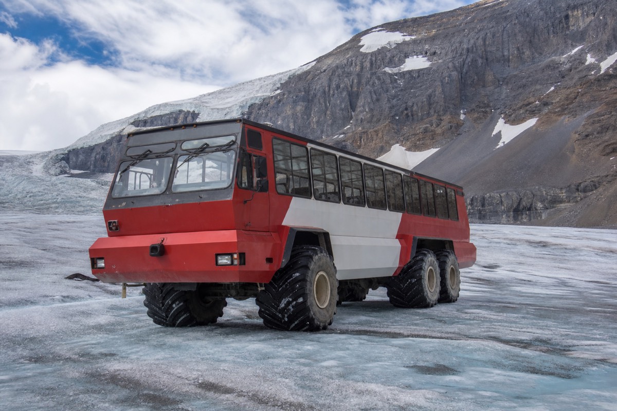
The rope at the toe is not decoration. Below the surface the ice is riven with crevasses that snow can bridge invisibly, and people who cross the barrier for a closer photo occasionally fall through. The safe options bracket the whole range of visitors: the vehicle ride for anyone at all, the guided walk for those who want hours on the ice under their own power. The rules and choices are set out fully in whether you can walk on the ice, and if you want to taste the source, see drinking the meltwater.
What are the ways to experience the glacier, compared?
There are four realistic ways to meet the Athabasca Glacier: the Ice Explorer ride, a guided walk on the ice, the free trail to the toe, and the Wilcox Pass hike for the classic elevated view. They differ hugely in effort, cost, time and how close you get, so the right one depends on your group and your day.
The Ice Explorer is the accessible headline and the guided walk is the deeper version, both putting you on the ice. The toe trail is a short free walk to a viewpoint at the barrier, not onto the glacier. Wilcox Pass is a proper hike that rewards you with the postcard view down the length of the ice from a ridge. Many people pair the ride with the toe trail, or the Wilcox view with the Ice Explorer, to see the glacier from more than one angle.
| Way | Effort | On the ice? | Time | Best for |
|---|---|---|---|---|
| Ice Explorer ride | Very low | Yes, ~20 min roped zone | ~80 min | Families, first-timers |
| Guided glacier walk | Moderate to high | Yes, on foot with crampons | 2 to 5 hr | Active visitors |
| Toe trail | Low | No, to the barrier | ~1 hr return | Free viewpoint, self-drivers |
| Wilcox Pass hike | Moderate | No, elevated view | 2 to 3 hr | Hikers, photographers |
Can you hike to the toe of the glacier for free?
Yes. A short marked trail leads from a parking area to a viewpoint near the toe, taking about an hour round trip, and it is free. It brings you close to the ice and past the dated retreat markers, but it ends at a safety barrier: you are not permitted to step onto the glacier itself from here.
It is the best free thing to do at the icefield, and the markers make it quietly moving. The path is rough and can be icy or muddy, so grippy shoes matter, and the temptation to duck the barrier for a better shot is exactly what the barrier exists to stop. Treat the toe trail as the close-up view and one of the two guided options as the way onto the ice, and you get the full picture without the risk.
Where does the glacier's meltwater go?
Meltwater from the Athabasca Glacier feeds the Athabasca River, which flows north to the Arctic Ocean. The Columbia Icefield above it is a rare hydrological apex: water shed from the wider icefield reaches three different oceans, the Arctic, the Atlantic and the Pacific, from this one high plateau.
That triple-ocean fact is one of the genuinely remarkable things about the place, and it is easy to miss standing at the toe. The glacier you are looking at is the headwaters of a river system that crosses a continent. The meltwater channels show the start of that journey. Bring treated drinking water rather than assuming raw glacier water is safe.
| From the icefield | Reaches |
|---|---|
| Athabasca River (from this glacier) | The Arctic Ocean |
| North Saskatchewan River | Hudson Bay and the Atlantic |
| Columbia River system | The Pacific Ocean |
Why is the glacier ice so blue?
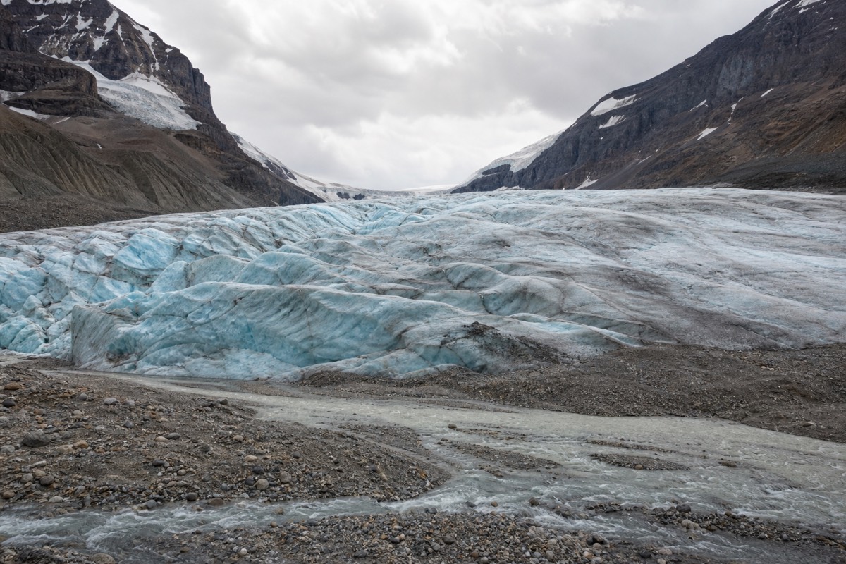
Deep, dense glacier ice looks blue because the pressure of centuries squeezes out the air bubbles, and the resulting solid ice absorbs the red end of sunlight while scattering the blue back to your eye. The whiter patches are younger, bubble-filled snow and ice near the surface; the vivid blue shows where the old, compressed ice is exposed.
It is the same physics that turns the meltwater lakes downstream their unreal turquoise, though there a second effect adds to it. As the glacier grinds over bedrock it mills the rock into an ultra-fine powder called rock flour, which washes into lakes like Peyto and Bow and hangs suspended in the water, reflecting that milky blue-green. So the colour you see on the ice and the colour you see in the lakes share a cause in the glacier itself. On an overcast day the blues deepen, because the flat light stops the white glare from washing them out, which is why photographers sometimes prefer cloud to sun up here.
What is it like to stand on the glacier?
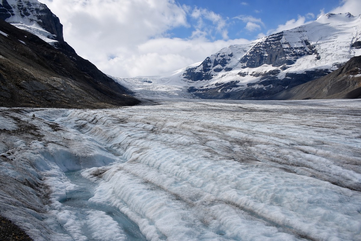
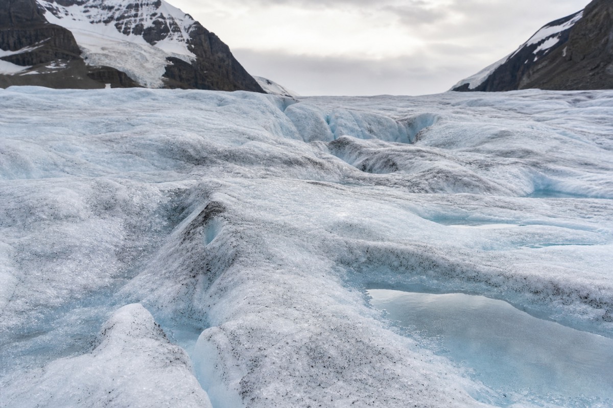
Colder, brighter and quieter than people expect. The ice is near freezing with a steady wind, the reflected sun is fierce enough to burn, and the surface is a rippled, gritty blue-white rather than the smooth sheet of imagination. Underfoot it crunches; nearby, meltwater runs in small blue channels you can hear before you see.
The scale is what stays with people. You are standing on hundreds of metres of ice that is itself moving, slowly, downhill, ringed by peaks that dwarf the giant vehicle that brought you. The roped zone keeps you safe, but even inside it the sense of being somewhere genuinely wild and old lands hard. Twenty minutes feels short and somehow complete. Bring a bottle and fill it from a meltwater rivulet if conditions allow, and keep the camera ready, because the light shifts fast as cloud moves across the icefield above.
When is the best time to see the Athabasca Glacier?
The glacier is visible year-round, but the ways to get onto it run seasonally, roughly mid-April to mid-October. Summer is warmest and busiest; September brings thinner crowds and golden larches; the shoulder weeks are quiet and cold. Whatever the month, early or late in the day is calmer and better lit than the mid-day peak.
In winter the glacier is buried in snow, the Ice Explorer and guided walks stop, and the road itself becomes a serious drive, so most visitors come between late spring and early autumn. The ice stays near freezing even in a hot July, so the season affects the crowds and the light far more than it affects how cold the glacier feels. More detail sits in the guide to the best months to visit.
| Period | Glacier access | Feel |
|---|---|---|
| Mid-April to May | Opening | Quiet, cold, deep snow |
| June to August | Full season | Warmest, busiest, long days |
| September | Open | Cool, gold larches, thinner crowds |
| October | Closing | Cold, short days, then shutdown |
| November to March | Closed to ice activities | Snow-buried, view only |
How do you get to the Athabasca Glacier?
The glacier sits on the Icefields Parkway at the Glacier Discovery Centre. From Jasper it is about 103 km, roughly an hour and a quarter; from Lake Louise around 130 km; from Banff about 185 km, two and a half to three hours; and from Calgary another two hours beyond Banff.
Fuel up before you leave, since the only pump on the route is at Saskatchewan River Crossing and cell service is effectively absent the whole way. The drive is one of the most scenic on earth, and many visitors let a guided day tour take the wheel so they can watch the ridgelines instead of the road. Our one-way glacier journey to Jasper even folds the glacier ride, the Skywalk and lunch into a single transfer, and the full route is covered in the guide to the Icefields Parkway drive. If you are deciding where to sleep, our notes on the drive up from Banff weigh the southern approach against a shorter run from Jasper.
| Start | Distance | Driving time |
|---|---|---|
| Jasper | ~103 km (64 mi) | ~1 hr 15 min |
| Lake Louise | ~130 km (80 mi) | ~1 hr 45 min |
| Banff | ~185 km (115 mi) | ~2.5 to 3 hr |
| Calgary | ~300 km (185 mi) | ~4.5 hr |
What should you wear on the glacier?
Dress for winter whatever the valley is doing. On the ice the air sits near freezing with a wind off the glacier, so layers, a windproof jacket, a hat, sunglasses and closed-toe shoes with grip are the baseline. Add sunscreen for the fierce reflected glare and a bottle for meltwater.
The most common mistake is trusting the town temperature, then shivering through the best twenty minutes of the trip. It runs far colder on the ice than in Banff or Jasper, and the sun bouncing off white ice burns faster than people expect. Grippy footwear is not optional, because the surface is slick. The full list is in the guide to what to wear on the ice, and the elevated Skywalk view pairs well with a glacier day, covered in the guide to the glass-floored Skywalk.
So how should you meet the Athabasca Glacier?
If you want it easy, ride the Ice Explorer and add the toe trail; if you want it deep, take a guided walk on the ice; if you want the classic photograph, hike to Wilcox Pass and look down the length of it. Whichever you choose, come soon, dress for winter, and give the place the half-day it deserves. The simplest way to see it well is to let a guided trip handle the long drive and the timing, and Columbia Icefield Tours lines up the operators who run the Parkway to the ice and back, so the glacier is the part you actually remember.